Difference between revisions of "CyberShake Central California 1D Model"
From SCECpedia
Jump to navigationJump to search| Line 26: | Line 26: | ||
[[File:Cross_sections_cca_srl.jpg|500px]] | [[File:Cross_sections_cca_srl.jpg|500px]] | ||
| − | [[File:Cca_bakersfield_we_vp.png| | + | |
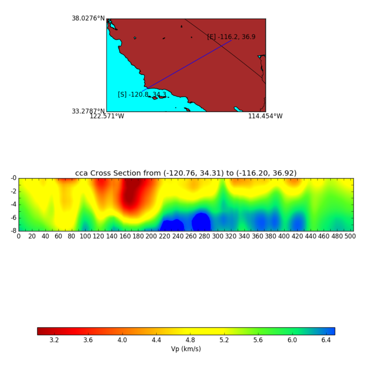
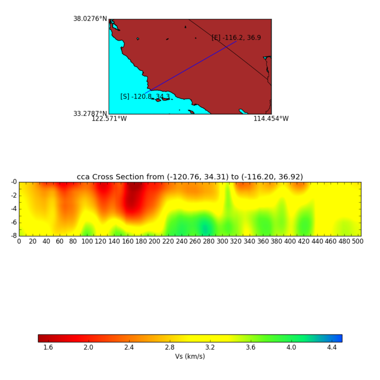
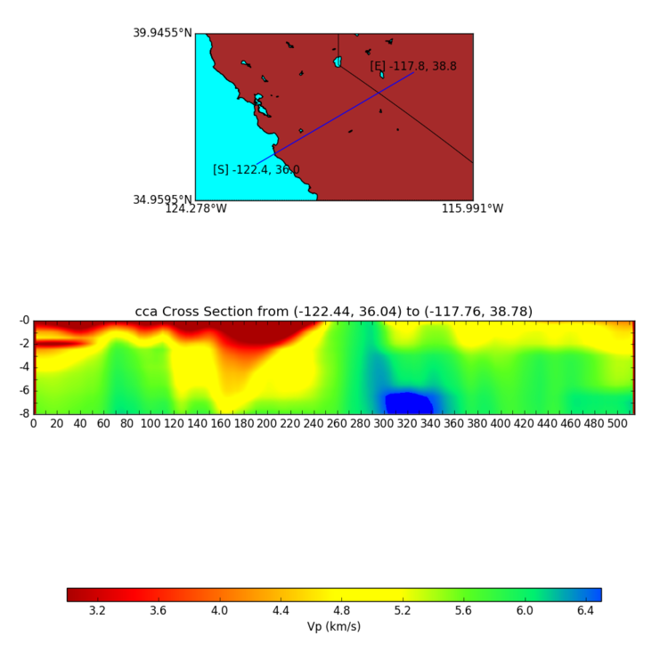
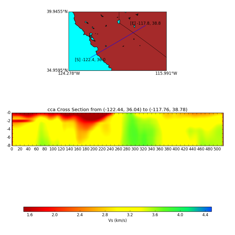
| − | [[File:Cca_bakersfield_we_vs.png| | + | === Bakersfield West-East === |
| + | |||
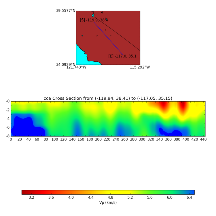
| + | [[File:Cca_bakersfield_we_vp.png|750px]] | ||
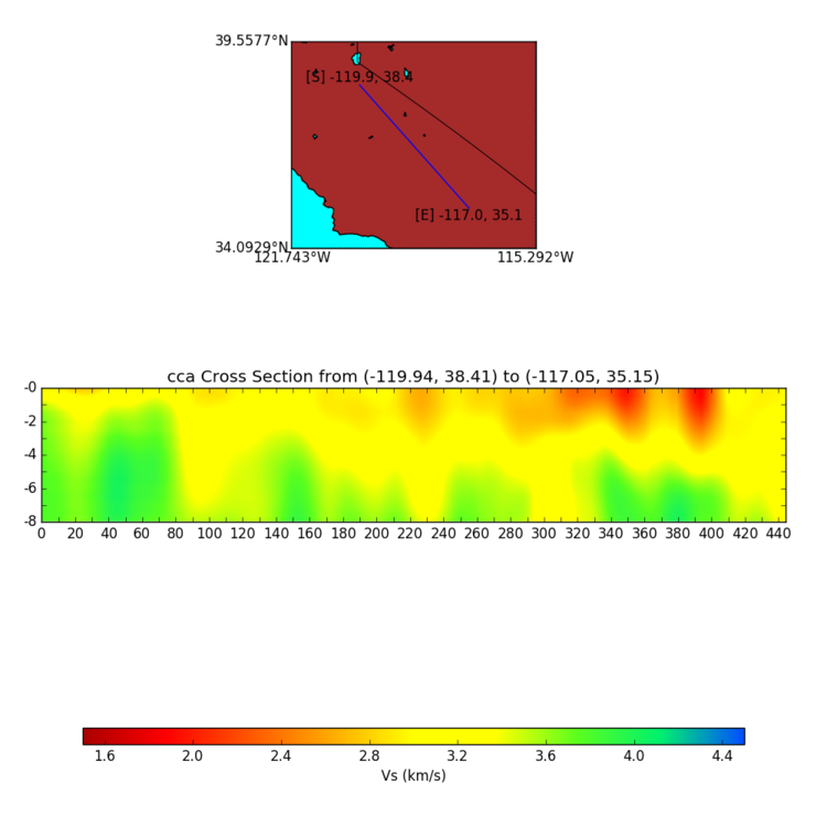
| + | [[File:Cca_bakersfield_we_vs.png|750px]] | ||
| + | |||
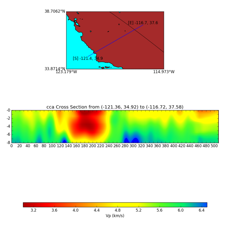
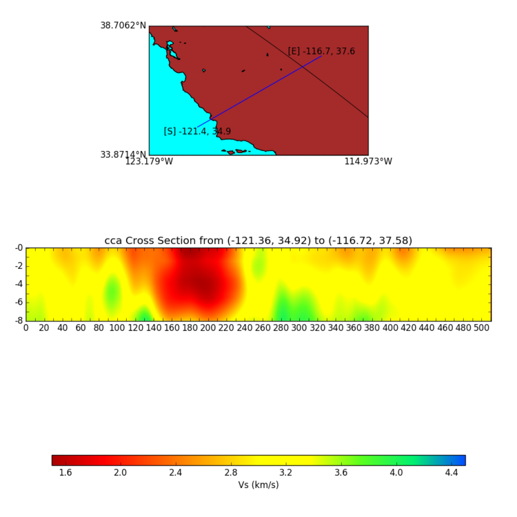
| + | === USGS Bay Area West-East === | ||
| + | |||
| + | [[File:Cca_cencal_we_vp.png|750px]] | ||
| + | [[File:Cca_cencal_we_vs.png|750px]] | ||
| + | |||
| + | === Diablo Canyon West-East === | ||
| + | |||
| + | [[File:Cca_diablo_canyon_we_vp.png|750px]] | ||
| + | [[File:Cca_diablo_canyon_we_vs.png|750px]] | ||
| + | |||
| + | === Coast North-South === | ||
| + | |||
| + | [[File:Cca_coast_ns_vp.png|750px]] | ||
| + | [[File:Cca_coast_ns_vs.png|750px]] | ||
| + | |||
| + | === Grapevine North-South === | ||
| + | |||
| + | [[File:Cca_grapevine_ns_vp.png|750px]] | ||
| + | [[File:Cca_grapevine_ns_vs.png|750px]] | ||
| + | |||
| + | === Mountains North-South === | ||
| + | |||
| + | [[File:Cca_mountains_ns_vp.png|750px]] | ||
| + | [[File:Cca_mountains_ns_vs.png|750px]] | ||
== Cybershake Study 14.2 1D Velocity Model == | == Cybershake Study 14.2 1D Velocity Model == | ||
Revision as of 16:50, 1 July 2016
Contents
Introduction
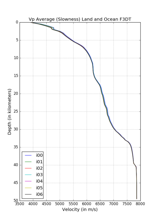
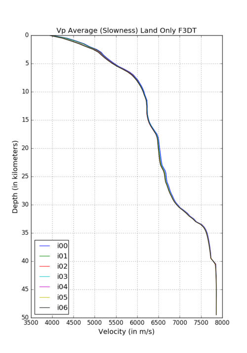
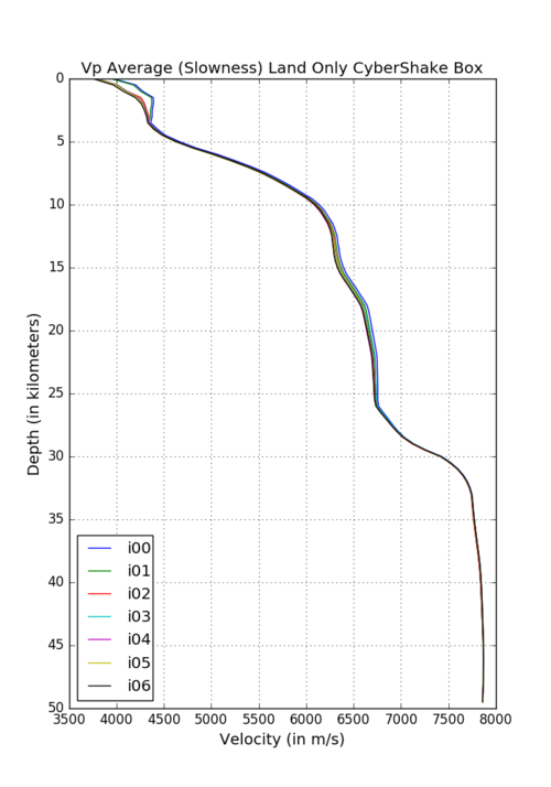
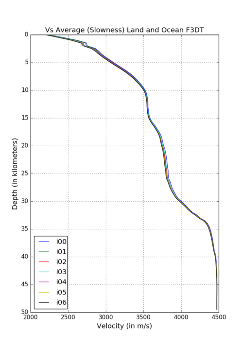
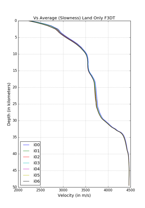
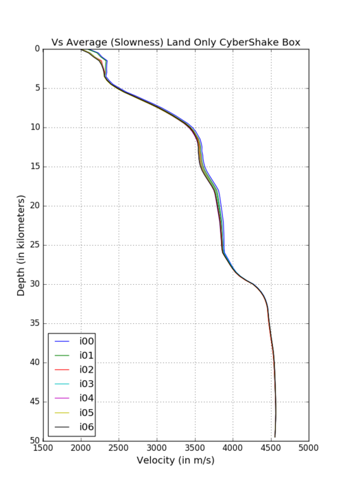
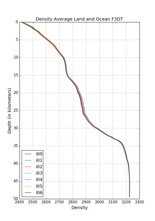
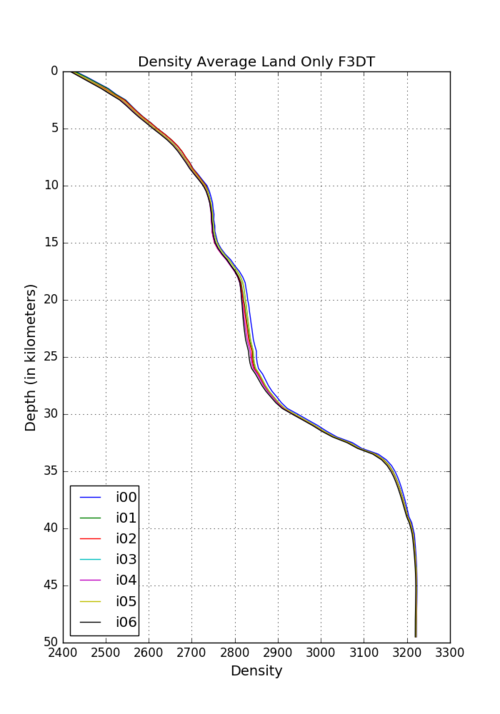
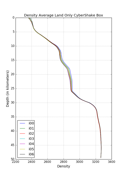
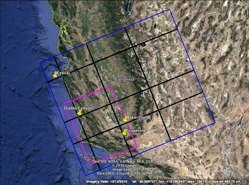
In preparation for a CyberShake run for Central California, we are evaluating possible 1D model alternatives. Three possible models would be averages of the full Central California region, the full CCA region minus any grid points in water, or the average of the CCA model within the CyberShake box on land only.
Vp Profiles
Vs Profiles
Density Profiles
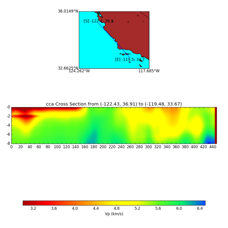
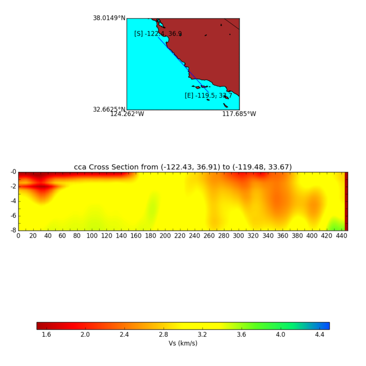
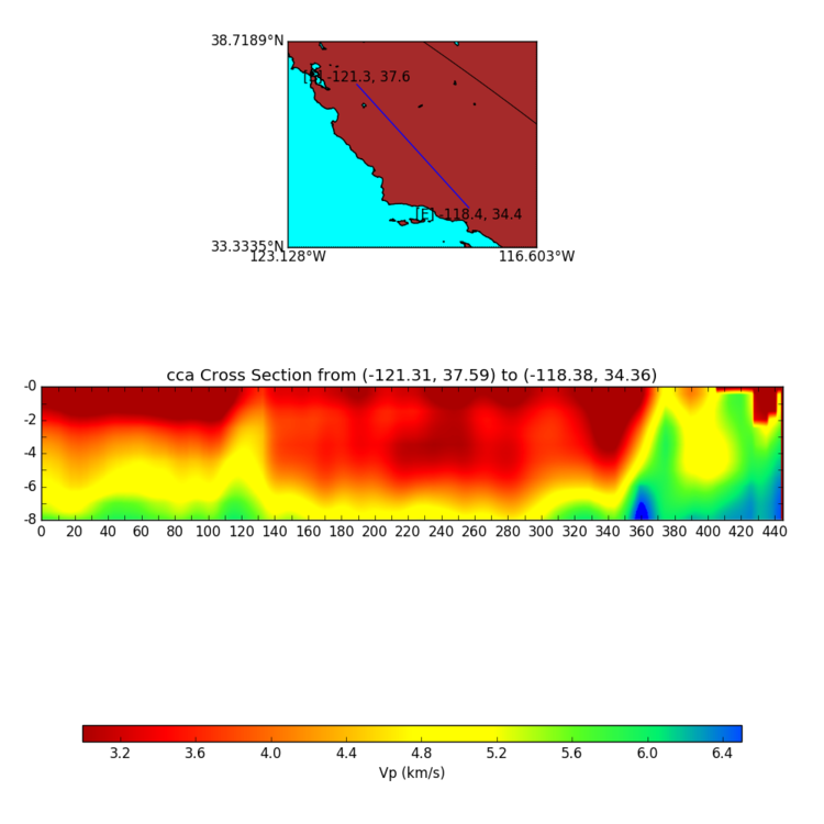
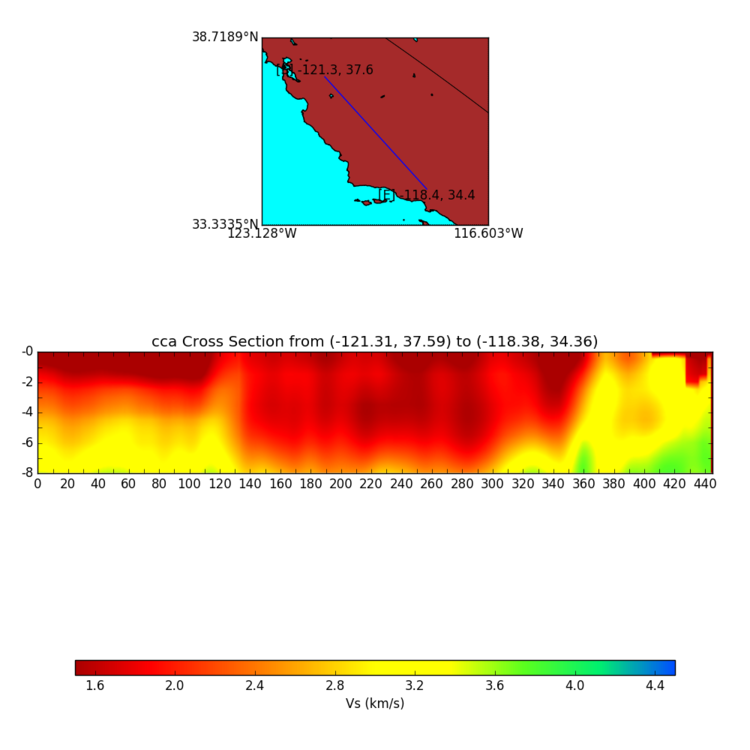
CyberShake Cross-Sections
These cross-sections replicate the color scheme of the SRL paper. They can help validate the CCA model and its geologic features.
