Difference between revisions of "SCEC NetCDF CVMS"
| Line 8: | Line 8: | ||
== CVM-H v15.1.1 == | == CVM-H v15.1.1 == | ||
The CVM-H model includes topography and standard queries are relative to sea-level (+ are above sea level, - are below sea level). UCVM utilities can be used to query the model and retrieve properties relative to ground level (+ are depth below earth surface). CVM-H provides optional geotechnical layers, either as a GTL by the model developers, and as an optional Ely-Jordn GTL which is based on Vs30 values. This CVM-H model uses the default "no background model" and "no GTL" configuration. | The CVM-H model includes topography and standard queries are relative to sea-level (+ are above sea level, - are below sea level). UCVM utilities can be used to query the model and retrieve properties relative to ground level (+ are depth below earth surface). CVM-H provides optional geotechnical layers, either as a GTL by the model developers, and as an optional Ely-Jordn GTL which is based on Vs30 values. This CVM-H model uses the default "no background model" and "no GTL" configuration. | ||
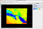
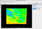
| − | *[[Image:CVM_H_vs_0km.png |left|150px]] | + | *[[Image:CVM_H_vs_0km.png |left|150px]][[Image:CVM_H_vs_5km.png|center|150px]] |
| − | |||
*[https://drive.google.com/file/d/1xCl64wS4SFZ9ZrraNvZAHMOsTi8eVuAf/view?usp=sharing CVM-H v15.1 NetCDF file] (532Mb) | *[https://drive.google.com/file/d/1xCl64wS4SFZ9ZrraNvZAHMOsTi8eVuAf/view?usp=sharing CVM-H v15.1 NetCDF file] (532Mb) | ||
Revision as of 16:49, 29 September 2021
Several California seismic velocity models are accessible through the UCVM software. The CVMs in UCVM are distributed in their original storage format, and they are accessible through the standardized UCVM query interface.
The IRIS Earth Model Collaboration uses NetCDF as a standardized format and SCEC has formated selected CVMS in netCDF format for users.
NetCDF resolution
The current SCEC netCDF file are discritized on a regular lat lon grid (0.01 degree increments) which is approximately 1km resolution in the horizontal (N-S) and 500m spacing in the vertical. The NetCDF format includes metadata describing the model.
CVM-H v15.1.1
The CVM-H model includes topography and standard queries are relative to sea-level (+ are above sea level, - are below sea level). UCVM utilities can be used to query the model and retrieve properties relative to ground level (+ are depth below earth surface). CVM-H provides optional geotechnical layers, either as a GTL by the model developers, and as an optional Ely-Jordn GTL which is based on Vs30 values. This CVM-H model uses the default "no background model" and "no GTL" configuration.
- CVM-H v15.1 NetCDF file (532Mb)
CVM-S4.26
The CVM-S4.26 is a tomographically improved CVM, based on the SCEC CVM-S4 starting model. In UCVM, this model is called CVM-S5. The tomographic processing imposed a min Vs of 900m/s in the starting model, which removed low Vs values from the model. In some cases, the tomography lower the resulting Vs values below 900m/s, but the model has few low Vs velocity areas. UCVM has options for adding low Vs values back into the model, but these methods are not used to create this NetCDF file.
- [[Image::CVM S4 26 vs 0km.png |left|150px]]
- [[Image::CVM S4 26 vs 5km.png |left|150px]]
- CVM-S4.26 NetCDF file (532Mb)

