CyberShake Central California 1D Model
Contents
Final Model
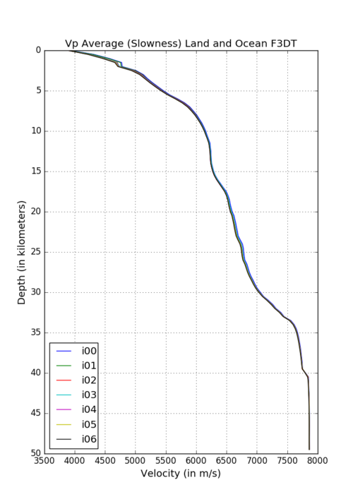
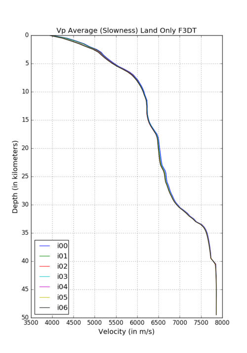
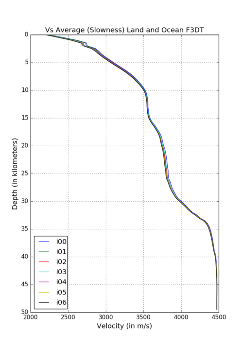
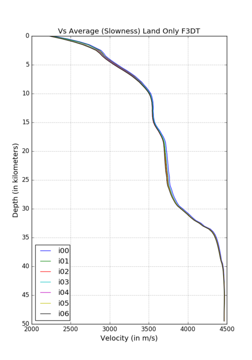
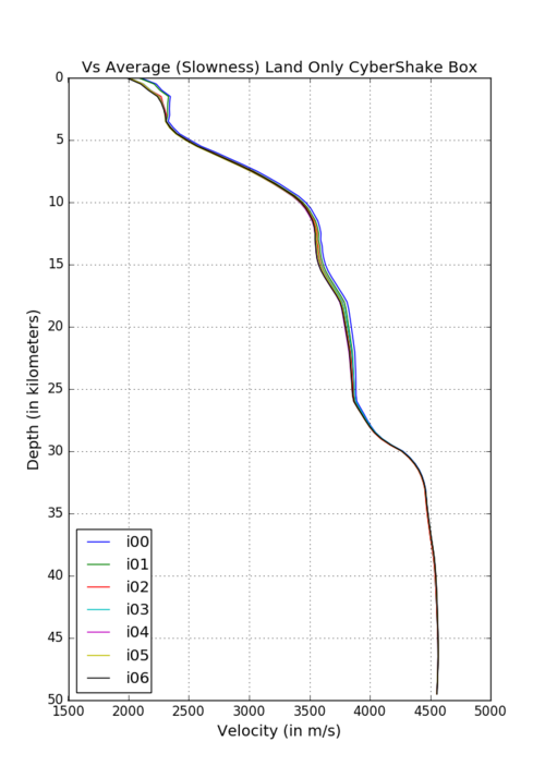
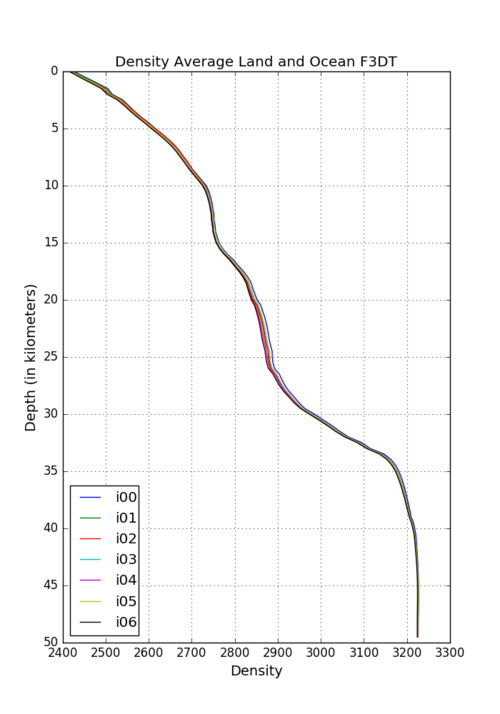
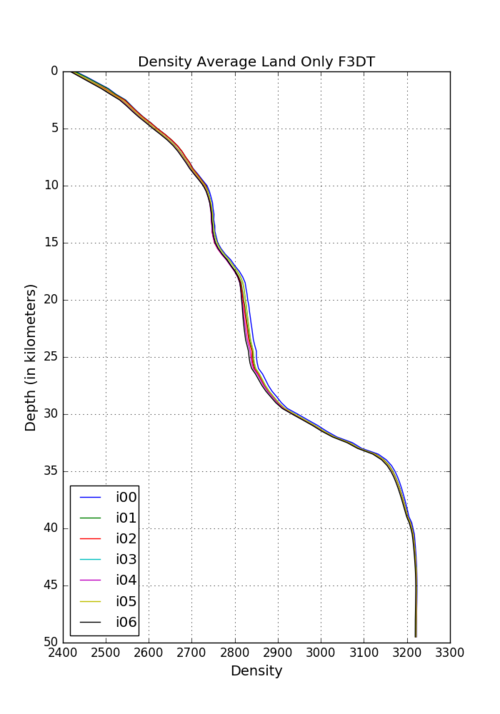
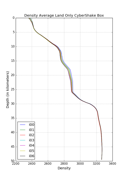
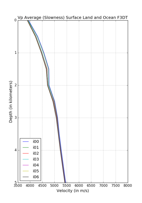
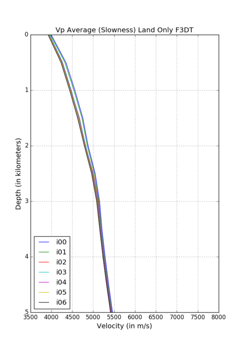
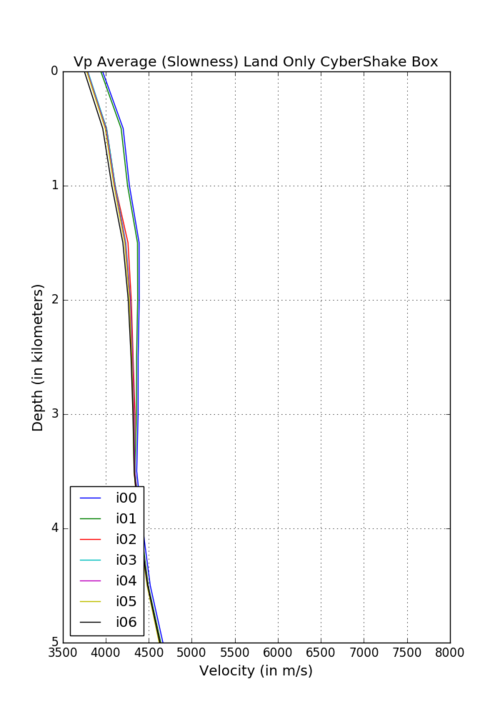
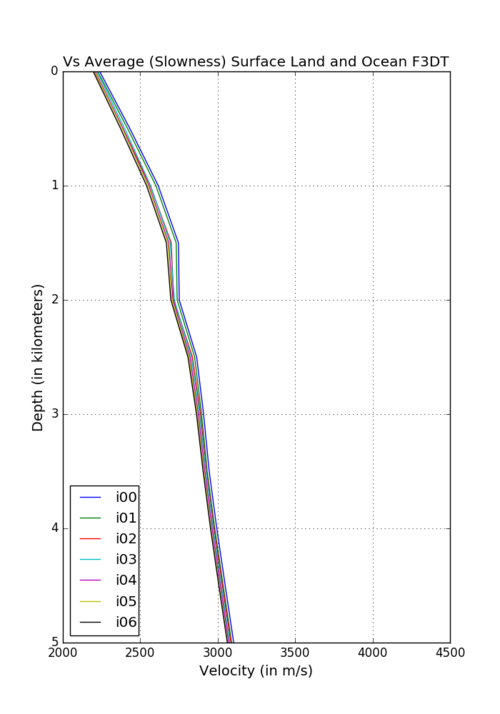
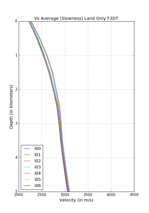
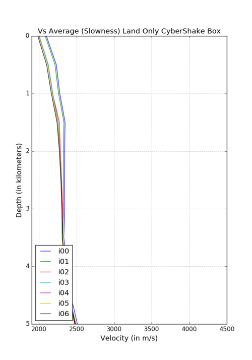
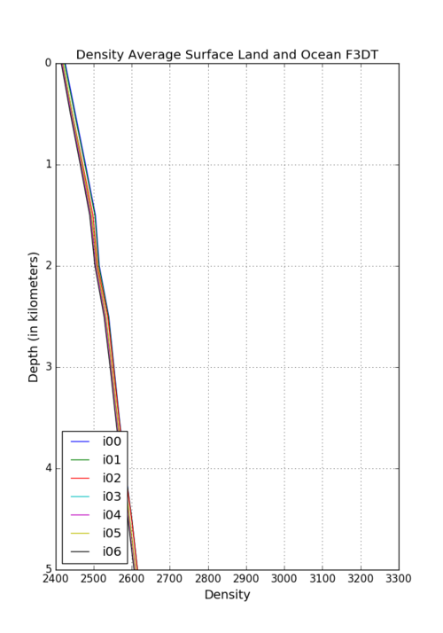
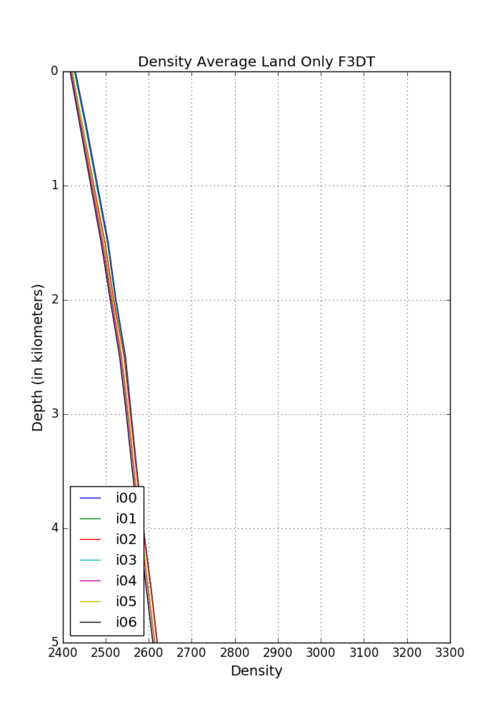
For the new CyberShake Central California run, we have evaluated possible 1D models. The section [Legacy Information] describes the three alternatives that were evaluated.
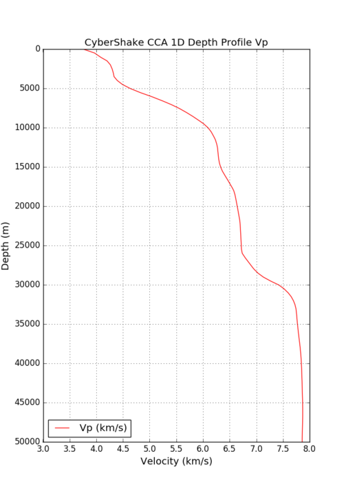
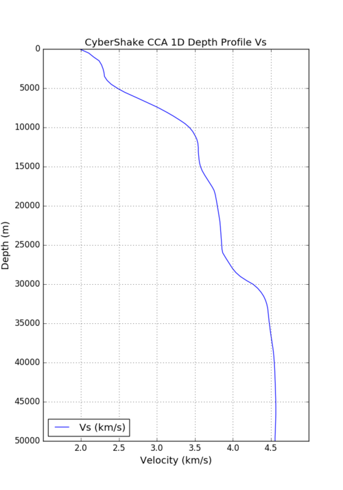
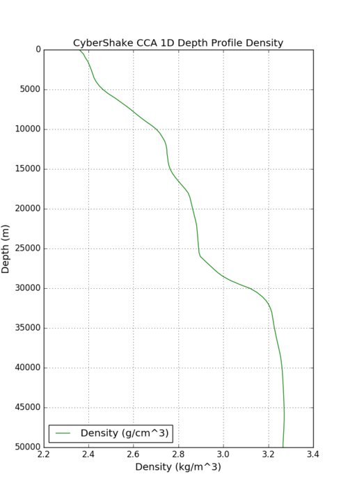
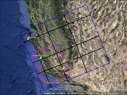
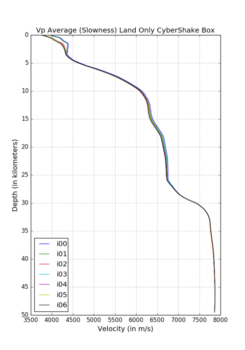
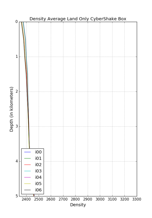
After evaluating the 1D models, the decision was to go with a 1D velocity model that represented the averages across the raw CCA data for all grid points that are on land and within the CyberShake box. The grid points would be linearly interpolated and the last layer of material properties would be extended downwards past where the original inversions end (i.e. material properties at depths greater than 50km = material properties at 50km).
In order to ensure reproducibility, the script used to create this model was checked in to the UCVM Git repository in the "cybershake_cca_1d" folder under the "scripts" branch. This branch will host all the miscellaneous scripts that are created, including instructions on how to run them. The script and everything that is included is viewable here: CCA 1D CyberShake Generator Script
The final agreed-upon model, in BBP-format, is located here: 1D BBP Configuration File
The included grid points are plotted here: Included Points
The final plots - as generated through UCVM, interpolated at 20m intervals - are as follows:
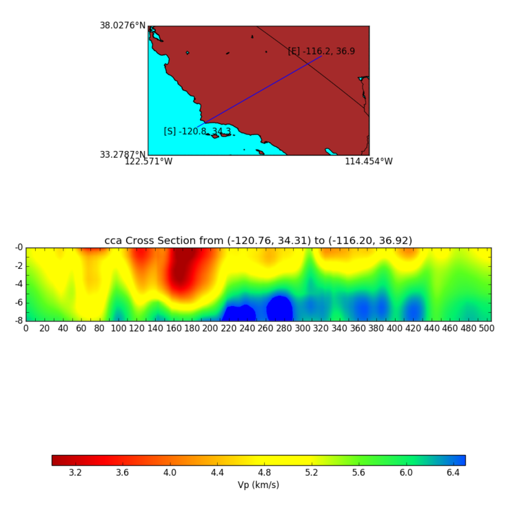
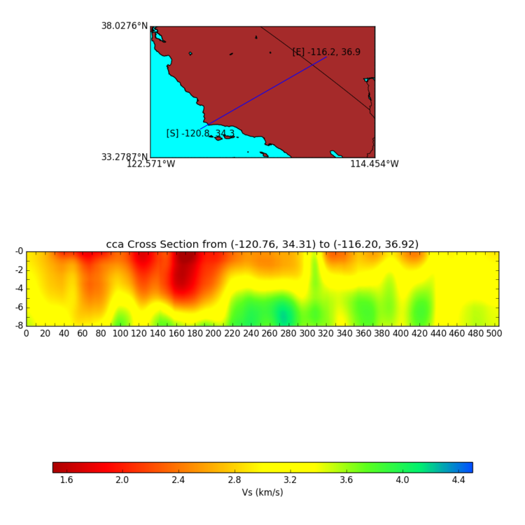
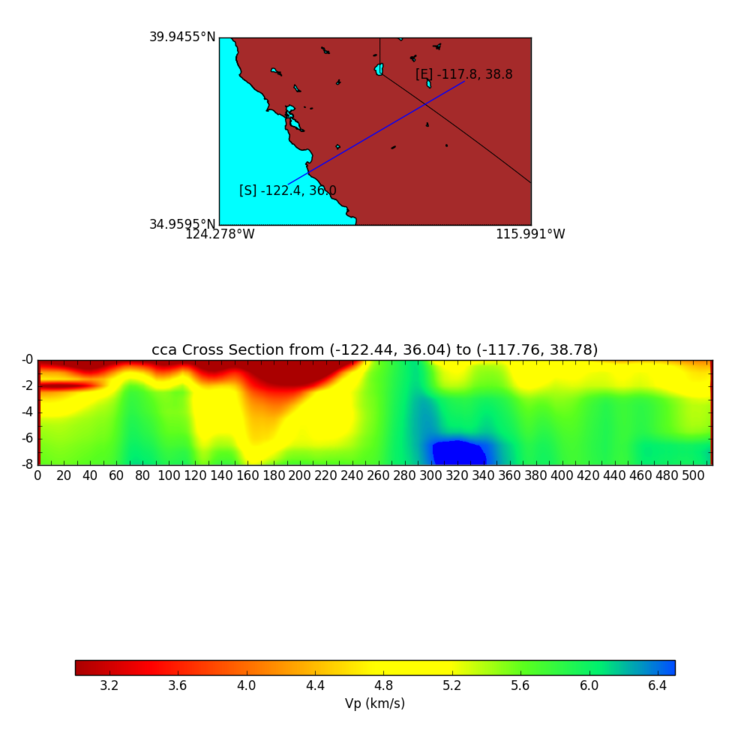
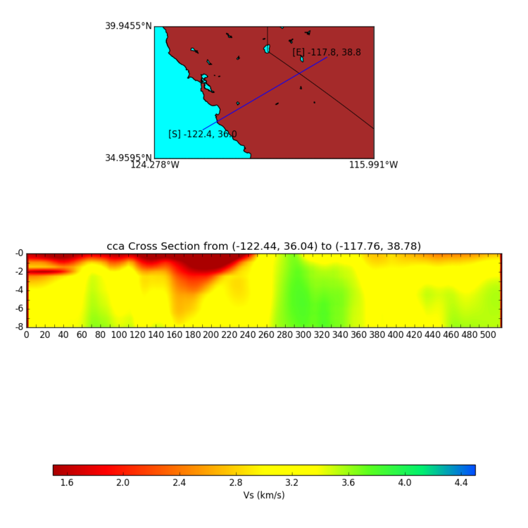
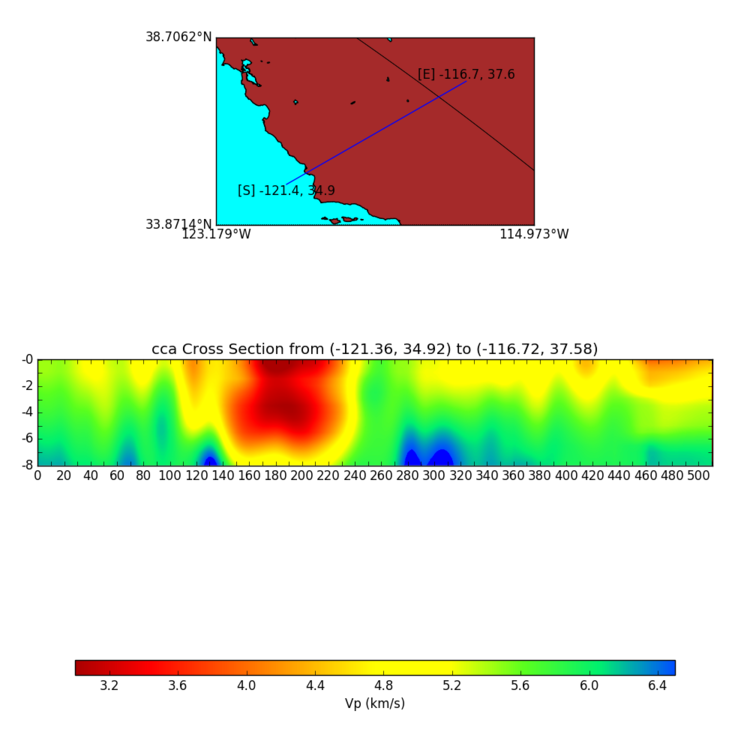
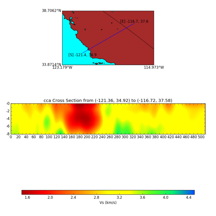
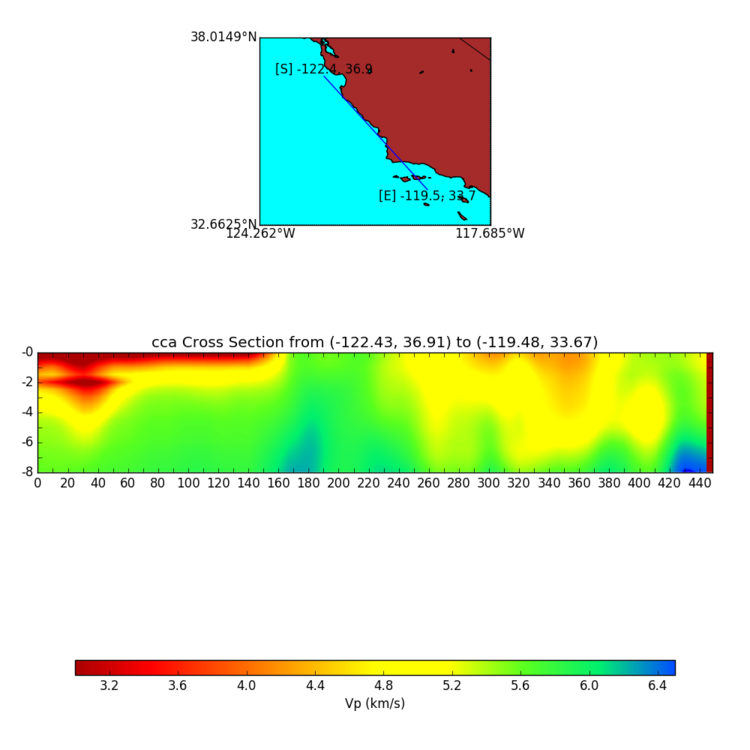
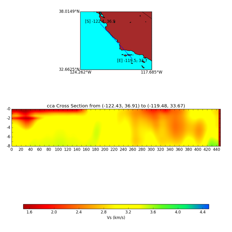
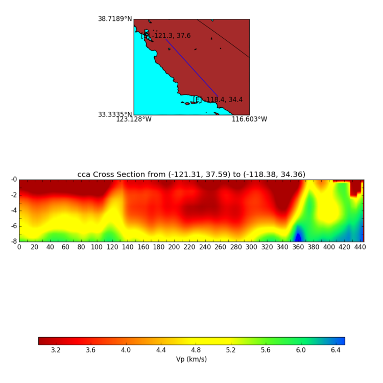
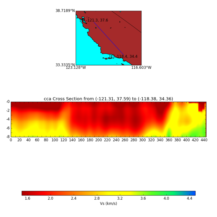
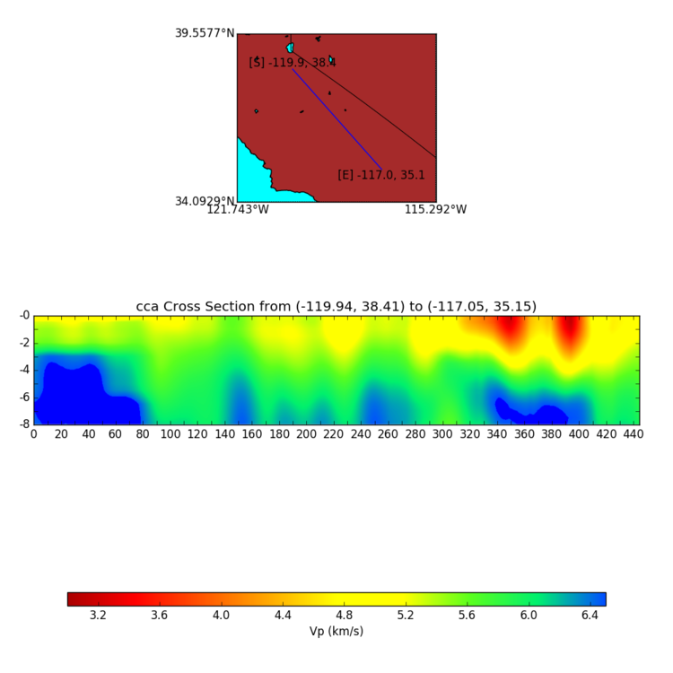
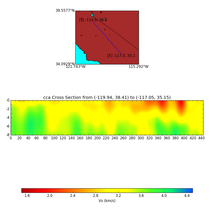
CyberShake Cross-Sections
These cross-sections replicate the color scheme of the SRL paper. They can help validate the CCA model and its geologic features.
Bakersfield West-East
USGS Bay Area West-East
Diablo Canyon West-East
Coast North-South
Grapevine North-South
Mountains North-South
Legacy Information
In preparation for a CyberShake run for Central California, we are evaluating possible 1D model alternatives. Three possible models would be averages of the full Central California region, the full CCA region minus any grid points in water, or the average of the CCA model within the CyberShake box on land only.
