UCVM 13.9.0
Introduction
Unified Community Velocity Model (UCVM) software framework is a collection of software tools designed to provide standard interface to multiple, alternative, California 3D velocity models. One important use of UCVM is in high resolution 3D wave propagation simulations for California. UCVM development is an interdisciplinary research collaboration involving geoscientists and computer scientists. UCVM geoscience research includes identification and assembly of existing California velocity models into a state-wide model and improvements to existing velocity models. UCVM computer science research includes definition of a easy-to-use CVM query interface, integration of regional 3D and geotechnical models, and automated CVM evaluation processing capabilities.
Download
| Platform | File | Download | Mirror |
|---|---|---|---|
| Linux | SCEC UCVM 13.9.0 Official Release (391 Mb) | ucvm-13.9.0.tar.gz | N/A |
| Linux | SCEC UCVM 13.9.0 md5 checksum (< 1Kb) | ucvm-13.9.0.tar.gz.md5 | N/A |
User Guide
We strongly recommend that you read through the UCVM user guide for more information on how to install and use UCVM.
Developer's Guide
Learn how to integrate your own velocity models and add other functionality to UCVM by visiting the UCVM developer guide.
What Does UCVM Include?
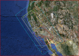
The following is the coverage region and projection for the included 2D elevation and Vs30 maps. The entire state of California is included, along with portions of Oregon, Nevada, Arizona, and northern Mexico.
