ShakeOut 2013 Response Planning
From SCECpedia
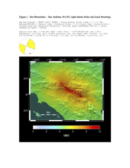
Jump to navigationJump to searchSCEC's research computing group used the ShakeOut 2013 event to practice creating useful earthquake and seismic hazard information for the SCEC community immediately after a large California event. We identified a series of digital data products that we can calculate using the software and system tools at SCEC, and posted the results on a SCEC wiki a soon as the results were available. We used one of the Northridge Near You event definitions, a scenario earthquake description for a San Bernardino M6.85, as the earthquake information available to us after a big event.
Contents
ShakeOut Home Page
Northridge Near You Events
Data Product Requirements
Each Data Product must include:
- Hardcopy of data product in Intern Lab at SCEC
- Digital version of product (posted on wiki)
- Metadata file describing data product (posted on wiki)
Computational Data Product Targets
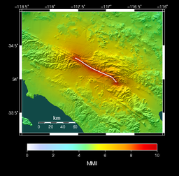
- MMI CyberShake map for event [ Fig. 2]
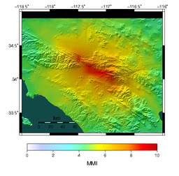
- Attenuation-relationship MMI ShakeMap (NRNY San Bernardino Event)
- Attenuation-relationship PGV ShakeMap (NRNY San Bernardino Event)
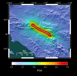
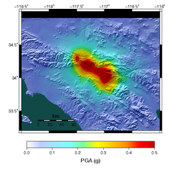
- Attenuation-relationship PGA ShakeMap (NRNY San Bernardino Event)
- SCEC-VDO 3D Aftershock visualization
- ShakeAlert Event Summary Test Result for Mainshock
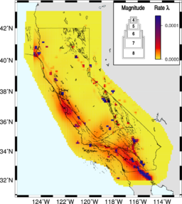
- Short Term Earthquake Probability (STEP) Map for next 24 hours
- Shakecast RSS (Receive and Send)
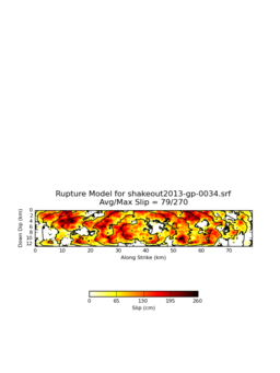
- BBP Source Description in SRF Format
- BBP MMI ShakeMap (NRNY San Bernardino Event)
- BBP PGV ShakeMap (NRNY San Bernardino Event)
- BBP PGA ShakeMap (NRNY San Bernardino Event)
Results Available Within 8 Hours
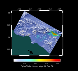
- CyberShake Map of Peak Spectral Acceleration at 3.0 Seconds for Same Event in CyberShake Catalog with CyberShake 13.4 CVM-S amplitudes at 200+ sites in Region.
- Attenuation-relationship MMI ShakeMap (NRNY San Bernardino Event)
- Attenuation-relationship PGV ShakeMap (NRNY San Bernardino Event)
- Attenuation-relationship PGA ShakeMap (NRNY San Bernardino Event)
- SCEC-VDO 3D Aftershock visualization
- ShakeAlert Event Summary Test Result for Mainshock
- Short Term Earthquake Probability (STEP) Map for next 24 hours
- Shakecast RSS (Receive and Send)
- BBP Source Description in SRC Format and Plot
- BBP Source Description in SRF Format
- BBP MMI ShakeMap (NRNY San Bernardino Event)
- BBP PGV ShakeMap (NRNY San Bernardino Event)
- BBP PGA ShakeMap (NRNY San Bernardino Event)
