Difference between revisions of "CyberShake Central California"
From SCECpedia
Jump to navigationJump to search| Line 10: | Line 10: | ||
*Eastern corner: (34.76, -118.35) | *Eastern corner: (34.76, -118.35) | ||
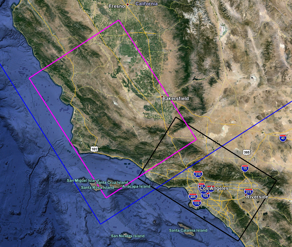
| − | Below is an image of the proposed box (in magenta; Southern California CyberShake box is in black, CCA region is in blue), with a kml of it [[ | + | Below is an image of the proposed box (in magenta; Southern California CyberShake box is in black, CCA region is in blue), with a kml of it [[Media:CCSP_CyberShake_Box_kml.kml | here]]. |
[[File:CCSP_CyberShake_Box.png]] | [[File:CCSP_CyberShake_Box.png]] | ||
Revision as of 03:36, 11 June 2016
We are planning to perform CyberShake studies in Central California, as part of the CCSP.
CyberShake Box
The proposed CyberShake box (in which CCSP CyberShake sites will fall) has dimensions 180km x 240km, at an angle of 55 degrees. Its coordinates are:
- Southern corner: (33.8, -119.93)
- Western corner: (35.52, -121.51)
- Northern corner: (36.5, -119.92)
- Eastern corner: (34.76, -118.35)
Below is an image of the proposed box (in magenta; Southern California CyberShake box is in black, CCA region is in blue), with a kml of it here.
