Difference between revisions of "Wills Map"
From SCECpedia
Jump to navigationJump to search| Line 1: | Line 1: | ||
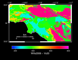
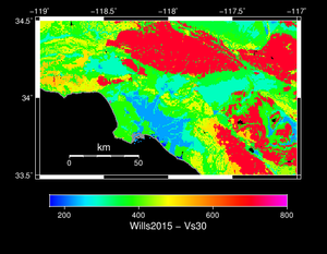
== Comparison of Wills Map 2006 versus 2015 == | == Comparison of Wills Map 2006 versus 2015 == | ||
| − | + | These two wills maps were made from gis files released by the state. | |
{| | {| | ||
| [[File:wills_2006.png|thumb|300px|Wills Map 2006]] | | [[File:wills_2006.png|thumb|300px|Wills Map 2006]] | ||
| Line 6: | Line 6: | ||
|} | |} | ||
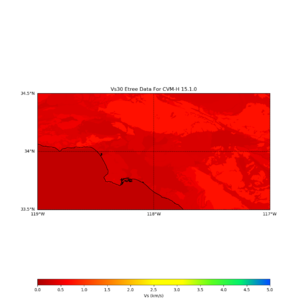
| − | + | These two wills maps are extracted by ucvm. The etree vs30 values are based on wills 2006, so we expect to see data from above in these maps. | |
{| | {| | ||
| [[File:Cvmh_nogtl_vs30_etree_map.png|thumb|300px|Vs30 Map based on UCVM Etree for 2006]] | | [[File:Cvmh_nogtl_vs30_etree_map.png|thumb|300px|Vs30 Map based on UCVM Etree for 2006]] | ||
Revision as of 03:11, 30 June 2018
Comparison of Wills Map 2006 versus 2015
These two wills maps were made from gis files released by the state.
These two wills maps are extracted by ucvm. The etree vs30 values are based on wills 2006, so we expect to see data from above in these maps.
Description of Wills Digital Map
 2015 is the latest version that I am aware of. The supplementary data of the paper provides the map as a GIS shapfile (http://www.seismosoc.org/Publications/BSSA_html/bssa_105-6/2015105-esupp/index.html). I then rasterized it to a binary floating point file (which similar to the 2006 file, except with floats instead of short ints) using the gdal_rasterize command (http://www.gdal.org/gdal_rasterize.html).

The original and rasterized data is stored here on opensha.usc.edu:

/export/opensha-00/data/siteData/wills_2015

I suggest you use raster_0.00025.flt, which is rasterized with 0.00025 degree spacing (~25 meters). The raster_0.00025.hdr file contains the necessary coordinates for georeferencing it, but I'll summarize here:

The first location in the file is at:

x/longitude/ULXMAP = -124.406528862058
y/latitude/ULYMAP = 42.0090923024621

This is the upper left (northwest) point in the map.

numX/numLon/NCOLS = 41104
numY/numLat/NROWS = 37900

Grid spacing (both X and Y): 0.00025 degrees

Data type: 4-byte/32-bit little-endian floating point numbers

Mesh ordering: fast XY, so the first few points are:

    Index 0 (at byte 0): -124.406528862058, 42.0090923024621
    Index 1 (at byte 4): -124.406528862058+0.00025, 42.0090923024621 = -124.406278862058, 42.0090923024621
    Index 2 (at byte 8): -124.406528862058+0.0005, 42.0090923024621 = -124.406028862058, 42.0090923024621
    ...


