Difference between revisions of "UCVMC"
| Line 31: | Line 31: | ||
#Supports tiling of models and background models. | #Supports tiling of models and background models. | ||
#Make AWP and ETree format meshes including parallel extractions. | #Make AWP and ETree format meshes including parallel extractions. | ||
| − | |||
| − | |||
| − | |||
| − | |||
| − | |||
| − | |||
| − | |||
| − | |||
| − | |||
| − | |||
| − | |||
| − | |||
| − | |||
| − | |||
| − | |||
| − | |||
| − | |||
| − | |||
| − | |||
| − | |||
| − | |||
| − | |||
== Related Entries == | == Related Entries == | ||
Latest revision as of 16:04, 19 June 2019
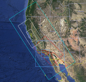
The Unified Community Velocity Model C-language (UCVMC) software framework is a collection of software tools designed to provide a standard query interface to multiple, alternative, California 3D velocity models. One important use of UCVMC is in high resolution 3D wave propagation simulations for California. UCVMC development is an interdisciplinary research collaboration involving geoscientists and computer scientists. UCVM geoscience research includes identification and assembly of existing California velocity models into state-wide models and improvements to existing velocity models. UCVM computer science research includes definition of a easy-to-use CVM query interface, integration of regional 3D and geotechnical models, and automated CVM evaluation processing capabilities.
The UCVMC codebase described in this wiki entry is the original C-language version of the UCVM software. UCVMC is a simplified version of the UCVM v15.10.0 software that was released in 2015. Essential features of that release are maintained in UCVMC, but several optional or experimental features and models are not included to make the software easier to install, use, and maintain. UCVMC is a supported and maintained SCEC software distribution. However, new UCVM developments are being made to an updated, Python language version, of UCVM, that is found under development under the UCVM name.
Contents
UCVMC Github Repository
The current UCVMC software distribution has been moved to a public github repository. The UCVMC Github repository also provides additional software documentation.
Software Installation and Usage
- UCVM Introduction
- UCVM System Requirements
- UCVM Installation From Source Code
- UCVM Installation From Virtual Box Appliance
- UCVM Basic Usage
- UCVM Automated Tests
- List of Registered CVMs
- List of UCVM Commands
UCVM_Introduction
The Unified Community Velocity Model (UCVM) software is open-source scientific software designed to support earth scientists, civil engineers, and other groups interested in detailed information about earth properties. UCVM is primarily used by scientists to work with earth material properties on regional scales.
UCVM software provides a software interface to one or more existing earth structure models. The earth structure models can be used directly without requiring UCVM. While UCVM adds complexity, it provides software capabilities that may be valuable to researchers. These UCVM specific capabilities include:
- Provides standard query interface to multiple CVM models with different projections.
- Converts query by elevation to query by depth to create comparable models.
- Provides standard methods for tri-linear interpolation, Vs30, and basin query from models.
- Provides plotting and analysis tools that make vertical profile, horizontal, and cross section plots.
- Provides tools to add gtl and ssh into models.
- Supports tiling of models and background models.
- Make AWP and ETree format meshes including parallel extractions.
