CyberShake
CyberShake is a SCEC research Project that is working to develop a physics-based computational approach to probabilistic seismic hazard analysis (PSHA). The CyberShake approach uses full 3D wave propagation simulations to forecast ground motions that will be produced by specific ruptures which is expected to produced significantly more accurate estimates for many sites than commonly used empirical-based ground motion decay attenuation relationships.
Project Summary
SCEC’s CyberShake Project utilizes 3D simulations and finite-fault rupture descriptions to compute deterministic (scenario-based) and probabilistic seismic hazard in Southern California. Computational demands are intense, requiring parallel algorithms and high throughput workflows. Long period effects such as coupling of directivity and basin response that cannot be captured with standard approaches are clearly evident in the recently completed CyberShake 1.0 hazard map. Moreover, CyberShake allows for rapid recomputation of the hazard map to reflect short-term probability variations provided by operational earthquake forecasting. Going beyond traditional hazard analysis, event-specific phenomena can also be identified and analyzed through examination of the individual ground motion waveforms. This process highlights the importance of key elements in the Earthquake Rupture Forecast that are required by the simulation approach, including magnitude-rupture area scaling, aleatory and epistemic magnitude variability and spatio-temporal rupture characterization.
Computational PSHA
CyberShake is a computationally intensive way to improve standard probabilistic seismic hazard analysis. The CyberShake method for calculating long-term seismic hazard analysis is not yet the standard method for calculating long-term seismic hazards in the United States. However, this computational technique has not been possible until recently. There are several way the CyberShake computational approach can improve on current PSHA calculations. Important improvements that CyberShake provides include:
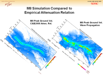
- Wave propagation simulations more accurately describe the distribution of ground motions than the currently used ground motion prediction equations [GMPE].
- Wave propagation simulations provide good estimates of both ground motion amplitude as well as ground motion duration.
[[Image:WaveProp v GMPE 1.PNG|356px|thumb|right|Fig 1: Ground Motion prediction equations and wave propagation simulations show similar distribution of peak ground motion by distance. However, the wave propagation simulation distribution shows significantly more realistic distribution reflecting directivity and basin structure response.]
Related Entries
UCVM UCERF3.0 CyberShake Workplan CyberShake SmartMap CyberShake Computational Estimates CyberShake Data Web Service - SRF Retrieval
One of the requirements for the 2010 USEIT intern class was to create a Standard Rupture Format (SRF) browser plugin for SCEC-VDO. This required a tool to retrieve SRF files from the CyberShake database. The 'GETCSSRF' web service was written to allow users to retrieve the SRF files from the CyberShake database.
This web service was written as a Python web.py application. The service takes a set of arguments to select the desired file out of the CyberShake database and returns the contents of the SRF file is found. The service also supports an option to list the set of supported CyberShake Earthquake Rupture Forecast and Rupture Variation Scenario versions.
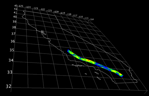
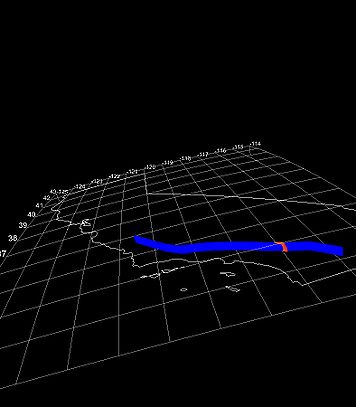
Fig 1. is a snapshot of the SCEC-VDO SRF Browser Plugin displaying a SRF file retrieved with the 'GETCSSRF' service from the CyberShake Database.
A video tutorial of the SRF browser plugin and the underlying SRF retrieval web service in action created by the USEIT interns can be found here: SRF Browser Plugin Tutorial
References
The SCEC CyberShake Project: A Computational Platform for Full Waveform Seismic Hazard Analysis Robert Graves (USGS), Scott Callaghan (USC), Patrick Small (USC), Gaurang Mehta (USC), Kevin Milner (USC), Gideon Juve (USC), Karan Vahi (USC), Edward Field (USGS), Ewa Deelman (USC/ISI), David Okaya (USC), Philip Maechling (USC), Thomas H. Jordan (USC)


