CyberShake SmartMap is a proposed GIS-based interface to the CyberShake Hazard Model (2009) and later. Current concept for the CyberShake SmartMap is to provide user with the ability to view collective CyberShake hazard information in map form, and to give the user the ability retrieve detailed hazard information for specific sites through a map-based interface.
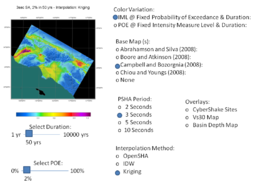
Fig 1:CyberShake SmartMap User Controls are showing in this diagram. User choice are made through toggle buttons, radio buttons, and sliders controls.
CyberShake SmartMap Powerpoint Examples
Images of User controls for CyberShake SmartMap.
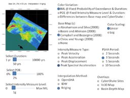
Fig 1:CyberShake SmartMap User Controls are showing in this diagram. User choice are made through toggle buttons, radio buttons, and sliders controls.
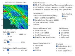
Fig 2:CyberShake SmartMap User Controls are showing in this diagram. User choice are made through toggle buttons, radio buttons, and sliders controls.
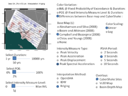
Fig 3:CyberShake SmartMap User Controls are showing in this diagram. User choice are made through toggle buttons, radio buttons, and sliders controls.
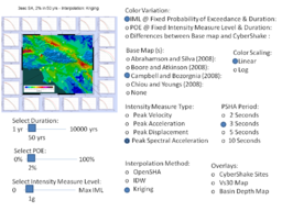
Fig 4:CyberShake SmartMap User Controls are showing in this diagram. User choice are made through toggle buttons, radio buttons, and sliders controls.
Related Entries
See Also


