M8
Contents
- 1 SCEC M8 Simulation
- 2 SC10 Presentations and Animations
- 3 M8 Press Coverage
- 4 M8 Data Products
- 5 SCEC and CME-related Web Sites
- 6 SCEC Computer Science Collaborative Organizations and Resource Providers
- 7 M8-related 2010 SCEC Annual Meeting Posters:
- 8 References
- 9 M8 Science Impacts
- 10 Related Entries
- 11 See Also
SCEC M8 Simulation
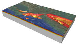
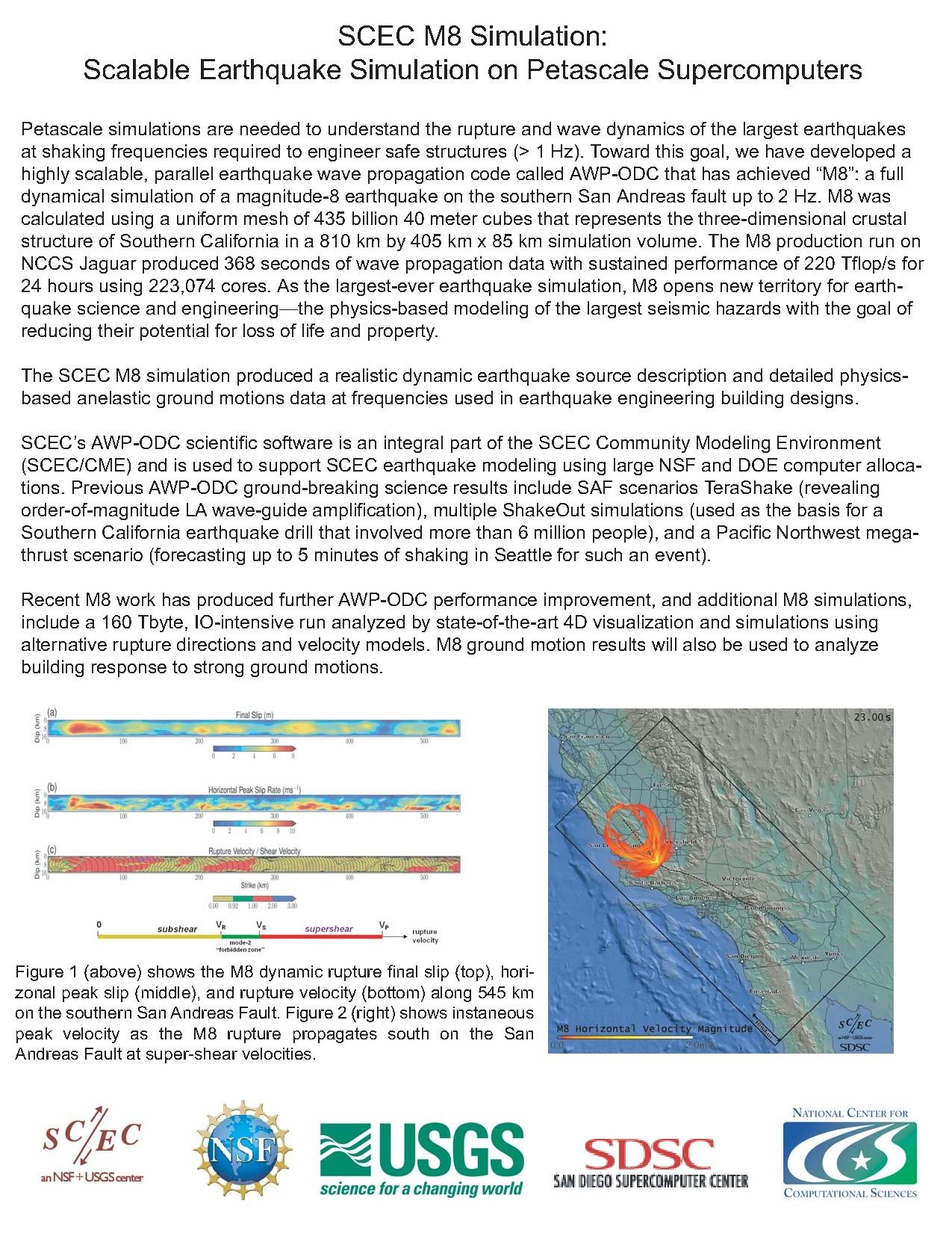
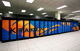
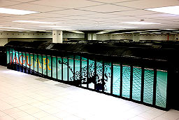
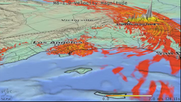
The SCEC M8 Simulation involved a very large dynamic rupture, run on NSF TeraGrid NICS Kraken in March, 2010, and a very large earthquake wave propagation simulation, run on DOE INCITE NCCS Jaguar in April 2010. M8 can be described as the largest earthquake wave propagation simulation ever performed for the following reasons:
- The M8 computational scale has a combined outer/inner scale of 10 ^ 4.3 (810km/40m)
- The April 2010 M8 science run, using SCEC's AWP-ODC software, achieved sustained performance on a real science problem for 24 hours in excess of 220Tflop/s. When this M8 simulation, no other seismic wave propagation software had achieved more than 100Tflop/s.
- The M8 wave propagation simulation, run on NCCS Jaguar, ran on 223k cores. No other seismic wave propagation application has been used on real science runs using more cores than M8.
- The M8 simulation software, SCEC's AWP-ODC, scaled nearly perfectly up to 223k cores.
- The M8 input velocity mesh required 435 billion grid points more than any wave propagation simulation at the time M8 was run.
The M8 Project is led by Yifeng Cui, Kim Olsen, and Thomas H. Jordan.
SC10 Presentations and Animations
- Thomas H. Jordan's Masterwork Talk
- Thomas H. Jordan's Gordon Bell Presentation
- Movie Bundle (340 MB)
- Rupture Comparison Movie
M8 Press Coverage
- Computeworld SC10 Article
- SDSC M8 Article
- Discovery News Article and Video
- HPCWire Coverage of M8
- SciTV Video of M8
- Orange County Register Article
M8 Data Products
M8 simulation input data files and simulation results are posted on this wiki page as they become available.
- Public CME Website
- Collaborative SCEC Wiki
- SCEC Home Page
- SDSC High Performance Geocomputing Laboratory
- PetaSHA3 Project
- CME Movies and Animations
- CVM-Toolkit
- SCEC Websims Data Management Site
- SCEC CSEP Testing Center
SCEC Computer Science Collaborative Organizations and Resource Providers
- SDSC Geohpcl
- SDSC
- SDSC HPGeoC
- SDSC Visualization Services
- Scientific Workflows at USC/ISI
- Fault Tolerant Computing at CSM
- USC HPCC
- PSC
- NICS
- NCCS
- TACC
- NCSA
- Blue Waters
- Open Science Grid
- SCEC/CME Overview
- CVM-Toolkit
- Geoff Ely Ground Motion Visualizations
- GlyphSea Vector Visualization
- Vs30-based Geotechnical Layer (GTL)
References
- Cui, Y., K. B. Olsen, T. H. Jordan, K. Lee, J. Zhou, P. Small, D. Roten, G. Ely, D.K. Panda, A. Chourasia, J. Levesque, S. M. Day, P. Maechling (2010), Scalable Earthquake Simulation on Petascale Supercomputers, Proceedings of the SC10 International Conference for HPC, Networking and Analysis. (Accepted as SC10 Gordon Bell Finalist).
M8 Science Impacts
M8 establishes computational capabilities needed to systematically assess seismic hazards by simulating ground motions caused by hypothetical, but plausible, earthquakes on faults in and around sedimentary basins.
M8 simulated ground motions can be coupled with the mechanics of buildings, tunnels, bridges, pipes, and rails to better constrain how to make such structures more earthquake proof, and to identify hazards and needed warning and monitoring systems. Similarly, they can be coupled to tsunami propagation models to estimate inundation risks.
Increased understanding of geophysical processes at many scales are required to develop more accurate models that can pinpoint hazards within population centers.
The M8 simulation represents that state of the art in seismic hazard simulations. It uses state of the art physics, with both physics-based dynamic rupture simulations to create the earthquake (source) description, and state of the art highly validated anelastic wave propagation modeling in a 3D velocity model.
It represents the state of the art in simulation scale. The geographical region (~800x400km), the number of mesh points (~450B), the simulated duration (6 minutes), the frequency content of the seismograms (2Hz), the computational scale (~223K cores), the computational duration (24hrs!)... all represent the limits of current capabilities for research of this type.
Recent large earthquake (Sumatra mw9.0 , Chile Mw8.8) make emergency response groups in California to ask how big an earthquake could happen here? What size earthquake is possible for California? Is an M8 possible? Is a M9 possible?
Earthquake magnitude depends on the length and depth of the fault that slips. Large magnitude events occur on large faults. The San Andreas runs through California. The full length extends nearly 1000km, capable of a M9.0. However current geological opinion is that the fault does not rupture end-to-end but northern and southern sections are separated by the creeping section near parkfield.
It's not likely to rupture through this region. So M9.0 are not considered plausible for the San Andreas. However, either north our south segment may be capable of a Magnitude 8.0 earthquake. So, we simulate a M8 on the southern section.
There have been several earlier attempts to simulate M8+ earthquakes in southern California including attempts in movies and television including Earthquake (1974) and 10.5 (2004)
SCEC M8 represents the state of the art in physics-based seismic hazard simulations, significantly more accurate than any other simulation of its kind. Much more accurate than these movies.
M8 represents a milestone calculation with largest geographical scale and highest resolution ever performed in a physics-based seismic hazard simulations scenario earthquake simulation.
SCEC M8 represents state of the art in physical realism, using two types of simulations, a spontaneous rupture simulation that models the physical principles in friction-based fault rupture processes, together with anelastic wave propagation in full 3d velocity structure with frequencies up to 2hz.
The simulation represents one possible earthquake scenario. Similar simulations shows that ground motions are greatly affected by rupture velocity, and rupture complexity. The M8 rupture has two significant sections of supershear rupture velocity, with strong ground motions in those areas.
The simulation ground motions are used to identify vulnerabilities of populated areas to this type of event. Peak velocity maps provide some indication of where strongest shaking would occur. Peak ground motions are compared to precarious rock sites to determine if ground motions exceed upper limits of these fragile formations. If so, this would argue the simulation ground motions are realistically high.
Simulation seismograms are used to evaluate building response in different areas.
Simulation sesimograms are used to evaluate earthquake early warning planning systems, by testing warning provide with current network configuration. Alternative network configurations also tested with simulation results.
Groups that manage risk information including building inventory and infrastructure deployment use the ground motions to evaluate the estimated losses for such an event based on their current inventories.
These simulations results help us better understand the rupture and wave propagation characteristics of our models. The simulation results are used by numerous groups (engineers, emergency response, geophysics) and contribute to a better understanding of seismic hazards in California. This better understanding helps refine public and private preparedness for both large and small events in California.
We are investigating with our M8 simulations is stress transfer between nearby faults. Can a rupture on one fault load up stress on nearby faults enough to initiate ruptures nearby? If fault loading like this can be shown to occur, it could lead to development of time dependent seismic hazard maps.
Related Entries
- M8 Simulation Specifications
- M8 Data Products
- M8 Narration
- VShaker
- SC10 Planning
- M8 EEW Analysis
- M8 PSHA Analysis
- Websims M8 Data Page
- SCEC Visualization Projects
- SCEC Websims Simulation Data Access
- Goodness of Fit
- CVM Toolkit
- CME Meeting 2010
